{{First_Name|Explorer}}, welcome back!🚀
This week brings some stunning images from deep space and intriguing research. Having trouble with links? Click below for the full newsletter experience.
Hope you enjoy this Space!

IMAGES
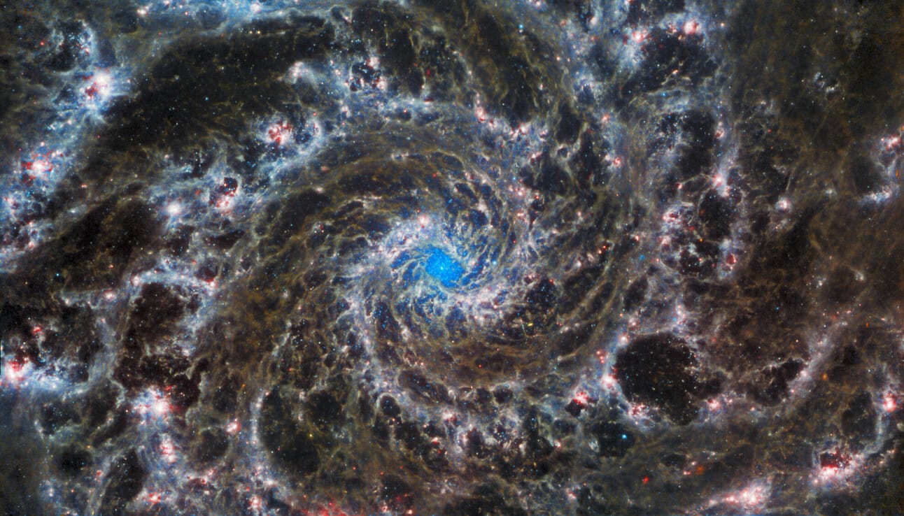
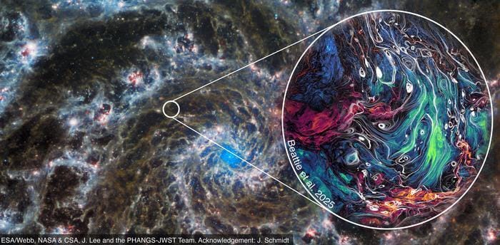
Magnetic Turbulence in Space : SuperMUC-NG Supercomputer, Leibniz Supercomputing Centre, Germany
Scientists have developed a high-resolution simulation to study the turbulent, magnetized interstellar medium of the Milky Way, revealing intricate swirling gas patterns and magnetic field structures that shape star formation and cosmic evolution.
Using the SuperMUC-NG supercomputer at the Leibniz Supercomputing Centre in Germany, researchers modeled how magnetic turbulence influences the density and movement of interstellar gas, uncovering deviations from traditional turbulence theories. The simulation spans 30 light-years but can scale down to 5,000 times smaller structures, allowing astronomers to analyze both large-scale galactic dynamics and localized star-forming regions.
These findings provide new insights into how magnetic pressure counteracts gravity, affecting the birth of stars and the distribution of cosmic material. The study also enhances our understanding of space weather, which impacts satellites and astronauts, reinforcing the importance of magnetic turbulence in astrophysical environments. The team included James Beattie, the paper’s lead author and a postdoctoral researcher at the Canadian Institute for Theoretical Astrophysics (CITA) at the University of Toronto, as well as co-authors from Princeton University, Australian National University, the Australian Research Council Center of Excellence in All Sky Astrophysics, Universität Heidelberg, Harvard University, and the Bavarian Academy of Sciences and Humanities. The simulation is described in a study published in the journal Nature Astronomy.
Tectonic Activity on Venus : Magellan Mission, NASA
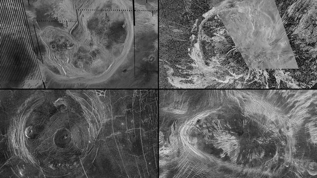
New research suggests vast surface features on Venus called coronae continue to be shaped by tectonic processes. Observations of these features from NASA’s Magellan mission include, clockwise from top left, Artemis Corona, Quetzalpetlatl Corona, Bahet Corona, and Fotla Corona. (Credit: NASA/JPL-Caltech)

This radar image, taken by the Magellan probe, depicts a 180-mile-wide (300-kilometer-wide) region on Venus’ surface, situated in an expansive plain south of Aphrodite Terra. Near the center, a large circular feature, known as a corona, measures approximately 120 miles (200 kilometers) in diameter and has been provisionally named Aine Corona. (Credit: NASA/JPL)
Researchers from Washington University in St. Louis analyzed data from NASA’s Magellan mission, gathered more than 30 years ago, uncovering signs of ongoing geological activity on Venus. Their study focused on coronae, vast circular features shaped by tectonic processes, suggesting that molten material continues to reshape the planet’s surface.
Unlike Earth’s plate tectonics, Venus appears to undergo localized surface deformation, a phenomenon that could resemble early Earth before its plates fully formed. Using gravity and topography data, the team identified 52 coronae with signs of subsurface movement, reinforcing the idea that Venus is not geologically dormant.
Upcoming missions like VERITAS, scheduled for later this decade, aim to provide high-resolution gravity mapping, offering deeper insights into Venus’ dynamic interior and its evolving landscape. The new study has been published in the journal Science Advances.

These illustrations depict various types of tectonic activity thought to persist beneath Venus’ coronae. Lithospheric dripping and subduction are shown at top; below are and two scenarios where hot plume material rises and pushes against the lithosphere, potentially driving volcanism above it. (Credit: Anna Gülcher, CC BY-NC)
Streaked Slopes on Mars : ExoMars Trace Gas Orbiter

CaSSIS camera aboard ESA’s ExoMars Trace Gas Orbiter captures dark finger-like slope streaks extending across Mars' dusty surface in Arabia Terra. New research by Bickel and Valantinas reveals these features form through dry avalanches triggered by wind and impacts rather than liquid water. These active geological phenomena may transport millions of tons of dust annually, potentially playing a significant role in Mars' climate system. (Credit: NASA)
A new study by Brown University and the University of Bern challenges previous theories about Martian slope streaks, suggesting they form through dry avalanches rather than liquid water flows. Using machine learning, researchers analyzed 86,000 high-resolution satellite images, finding that wind and dust activity—not water—trigger these streaks.
For decades, scientists debated whether these features indicated habitable environments on Mars. However, the study found no evidence of moisture-driven processes, reinforcing the idea that modern Mars remains extremely dry. These findings reshape expectations for future exploration, emphasizing the role of wind-driven geological activity in shaping the planet’s surface. The study was published on May 19 in the journal Nature Communications.
Lunar Helium-3 Harvester Prototype : Interlune, Vermeer

Seattle-based startup Interlune has unveiled a full-scale prototype of its helium-3 harvester, developed in partnership with Vermeer Corporation. The machine is designed to excavate 100 metric tons of lunar regolith per hour, extracting helium-3—a rare isotope with potential applications in fusion energy, quantum computing, and medical imaging. Shown here the testing was done with auxiliary components. The final Interlune excavator hardware will be integrated with the Interlune Harvester. (Credit: Interlune)

A artist’s rendering of the Interlune Harvester, which will incorporate excavation hardware developed in partnership with Vermeer. (Credit: Interlune)
Helium-3 is scarce on Earth but abundant on the Moon, deposited over millennia by solar wind. While mining efforts have been discussed for years, large-scale extraction has never been attempted. Interlune’s prototype represents a step toward commercial lunar resource utilization, though challenges remain, including high costs and transportation logistics.
The harvester is part of a four-step system—excavate, sort, extract, and separate—aimed at efficiently processing lunar materials. The company previously tested a subscale version and now moves toward further development, positioning itself within a growing lunar economy.

SCIENCE
Venus Aerospace Demonstrates Rotating Detonation Rocket Engine Hypersonic Flight Test
14 May, 2025
Houston-based Venus Aerospace has completed the first U.S. flight test of a Rotating Detonation Rocket Engine (RDRE), marking a significant milestone in hypersonic propulsion. The test took place at Spaceport America in New Mexico, where a small rocket equipped with the RDRE successfully launched, proving the engine’s viability beyond laboratory conditions.
RDRE technology, theorized since the 1980s, offers higher efficiency and thrust compared to traditional rocket engines by using a continuous detonation wave rather than steady combustion. Venus Aerospace aims to integrate this breakthrough with its VDR2 air-breathing detonation ramjet, enabling sustained Mach 6 flight from conventional runways.
The company sees this as a step toward affordable hypersonic travel, with potential applications in commercial aviation and defense. Future tests will focus on scaling the technology for Stargazer M4, a reusable passenger aircraft designed for Mach 4 speeds.
India’s PSLV Suffers Earth Observation Mission Failure After Third-Stage Anomaly

A PSLV pre-launch on May 18 IST, carrying the EOS-09 radar imaging satellite. (Credit: ISRO)
18 May, 2025
India’s latest Earth observation satellite mission ended in failure after the Polar Satellite Launch Vehicle (PSLV-C61) encountered an anomaly in its third stage. The EOS-09 satellite, equipped with synthetic aperture radar (SAR) for all-weather imaging, lifted off from Satish Dhawan Space Centre on May 18, 2025, but failed to reach orbit due to a drop in chamber pressure in the rocket’s third stage.
The Indian Space Research Organisation (ISRO) confirmed that the first two stages performed normally, but the issue in the third stage prevented mission success. EOS-09 was intended to enhance India’s remote sensing capabilities, particularly for border surveillance and environmental monitoring.
This marks only the third failure in the PSLV’s 32-year history, highlighting the challenges of spaceflight despite the rocket’s reputation as India’s workhorse launch vehicle. ISRO has launched an investigation to determine the exact cause of the failure.
China Expands Space Initiatives with Tianwen-2 Asteroid Sampling Mission, Communications Satellite Launch, and Tiangong Shield Upgrades
18 May, 2025
China is advancing its space ambitions with two major missions this month. The Tianwen-2 asteroid sampling mission, scheduled for May 28, will mark China’s second deep-space exploration effort. The spacecraft, launched aboard a Long March 3B rocket, will first collect samples from 469219 Kamoʻoalewa, a near-Earth asteroid, before using Earth’s gravity to slingshot toward comet 311P/PANSTARRS for further study. The mission aims to enhance planetary exploration capabilities and provide insights into small celestial bodies, potentially contributing to planetary defense research.
20 May, 2025
Meanwhile, China has also launched a classified communications satellite, ChinaSat-3B, aboard a Long March 7A rocket from Wenchang Satellite Launch Center. While officially described as a civilian satellite, its lack of public details suggests possible military applications. Additionally, a Ceres-1 solid rocket conducted a commercial sea launch, deploying four satellites for the Tianqi Internet-of-Things constellation, which aims to improve global connectivity, particularly in remote regions.
22 May, 2025
Separately, Chinese astronauts aboard the Tiangong space station have completed an eight-hour spacewalk, installing debris shields to protect the station’s exterior. The mission, conducted by Shenzhou-20 crew members Chen Dong and Chen Zhongrui, marks the 19th extravehicular activity (EVA) since Tiangong became operational.
The astronauts exited through the Tianhe module’s airlock, using the station’s robotic arm to position protective sheets designed to safeguard external cables and equipment from space debris impacts. The growing risk of orbital debris has made such upgrades increasingly necessary.
This spacewalk is part of China’s broader efforts to maintain and expand Tiangong, which was completed in 2022 and is expected to remain operational for at least a decade. The Shenzhou-20 crew, who arrived in April 2025, will continue their six-month mission, supporting ongoing research and maintenance.
Microbial Findings in Cleanrooms and Space Stations Highlight Contamination Risks and Opportunities
Recent microbial discoveries in space-related environments are offering valuable insights into extreme survival mechanisms, with potential applications in biotechnology, planetary protection, and astronaut health.

Scanning electron microscopy images of some of the novel species isolated from the Phoenix spacecraft assembly cleanroom. (Credit: Schultz et al., Microbiome (2025))
A study conducted by NASA’s Jet Propulsion Laboratory, in collaboration with researchers from India and Saudi Arabia, identified 26 previously unknown bacterial species thriving in the NASA cleanrooms—facilities designed to prevent microbial contamination of spacecraft—that were used to prep the 2007 Phoenix Mars lander mission. These extremophiles possess genetic traits linked to radiation resistance, DNA repair, and detoxification, suggesting they could survive harsh space conditions. Scientists believe these microbes could inform planetary protection strategies while also offering insights into biotechnology, medicine, and food preservation. The study on the research was published May 12 in the journal Microbiome.
Meanwhile, Chinese researchers have discovered a new bacterial species, Niallia tiangongensis, aboard the Tiangong space station. Found on cockpit controls, this microbe exhibits adaptations such as biofilm formation, oxidative stress response, and radiation damage repair, potentially aiding survival in microgravity. While its origins remain unclear, its closest Earth-based relative has been linked to infections in immunocompromised individuals, prompting further study into its potential health risks.
Described in a peer-reviewed paper published this March in the International Journal of Systematic and Evolutionary Microbiology, the newly identified microbe is an aerobic, rod-shaped bacterium capable of forming spores.
MIT Researchers Examine How the Moon’s Rocks Retain Magnetism Without a Magnetic Field
Recent research led by MIT scientists has provided new insights into the Moon’s puzzling magnetic anomalies. While the Moon lacks a global magnetic field today, certain lunar rocks exhibit strong magnetization, particularly on the far side.
A study suggests that a massive asteroid impact may have temporarily amplified the Moon’s weak magnetic field billions of years ago. Simulations indicate that the impact generated a plasma cloud, which concentrated on the opposite side of the Moon, intensifying the local magnetic field. Rocks in the region may have recorded this short-lived surge before the field dissipated.
The researchers propose that the impact, possibly the one that formed the Imbrium basin, triggered seismic shockwaves that converged on the far side. These waves likely caused electrons in nearby rocks to "jitter" just as the magnetic field peaked, effectively locking in the field’s orientation like a geological snapshot. The entire sequence may have lasted less than an hour but left behind a magnetic signature still detectable today. The study was published in the journal Science Advances.

GOVERNANCE
NASA’s Jet Propulsion Laboratory Ends Telework Policy Amid Budget Concerns, Impacting Over 1,000 Remote Employees
22 May, 2025
NASA’s Jet Propulsion Laboratory (JPL) is ending its telework policy, requiring over 5,500 employees to return to full on-site work by August 25 for California-based staff and October 27 for remote workers outside the state. The decision follows budget concerns, as NASA faces a potential 25% funding reduction under the Trump administration’s 2026 budget proposal.
JPL, managed by Caltech, has already undergone two rounds of layoffs, cutting 12% of its workforce in 2024 due to funding shortfalls. The new policy effectively forces remote employees to either relocate or resign, raising concerns about silent layoffs without severance. Officials cite the need for collaboration and innovation, but critics argue the move disproportionately affects teleworkers amid broader NASA budget constraints

MILITARY
US Announces $175B Golden Dome Missile Defense Initiative

General Michael Guetlein at an office call with Colombian and Norwegian defense leaders in the Pentagon in April 2024. (Credit: United States Space Force via X)
20 May, 2025
The U.S. is moving forward with an ambitious space-based missile defense system, known as Golden Dome, aimed at countering hypersonic and ballistic missile threats. President Donald Trump announced the program at the White House, stating it will cost $175 billion and take three years to develop.
The system will feature space-based interceptors, capable of detecting and neutralizing missile threats mid-flight. U.S. Space Force General Michael Guetlein, Vice Chief of Space Operations, has been appointed to lead the effort.
In a statement, the Department of Defense has requested an initial $25 billion in funding as part of a broader legislative package. However, experts warn that the actual cost could be significantly higher, with estimates ranging from $161 billion to $542 billion.
International reactions have been mixed, with China expressing concerns over the program’s potential offensive capabilities, while Russia has acknowledged it as a sovereign U.S. decision
US Defense Expands AI-Driven Geospatial Intel Gathering as Palantir, Ursa Space, & University of Illinois Secure Contracts
21 May, 2025
At the GEOINT Symposium, being held in St. Louis, Missouri (U.S.) the U.S. defense sector highlighted its increasing reliance on AI-driven geospatial intelligence and commercial partnerships.
The Pentagon announced a $795 million expansion of its contract with Palantir Technologies, up from $480 million in 2024, bringing total funding for the Maven Smart System to $1.3 billion. Originally launched by the Pentagon in 2017, Project Maven uses AI to analyze battlefield imagery, enhancing military threat detection and decision-making. The expansion is meant for U.S. combatant commands, which are responsible for overseeing military operations across different geographic regions. It reflects a growing demand for automated intelligence processing, as these commands increasingly rely on AI-driven tools to analyze battlefield data and support decision-making.
Meanwhile, the National Geospatial-Intelligence Agency (NGA) awarded contracts to Ursa Space Systems, the University of Illinois, and Palantir. Ursa Space secured a Luno A $13.8 million task order to provide commercial analytics on petroleum production and storage, supporting global economic monitoring.
Luno A, valued at $290 million and lasting five years, is a commercial data contract from the NGA focused on unclassified geospatial intelligence (GEOINT). Using computer vision and AI analytics to monitor global activities, it integrates satellite imagery and commercial analytics into national security operations. Other Luno A contract holders include Airbus U.S., Booz Allen Hamilton, and Maxar Intelligence.
The University of Illinois received $25 million to advance high-performance computing for AI-driven geospatial intelligence, while Palantir won $28 million to expand access to Maven Smart System for intelligence analysts.
Satellites to Play a Key Role in Enhancing Maritime Domain Awareness
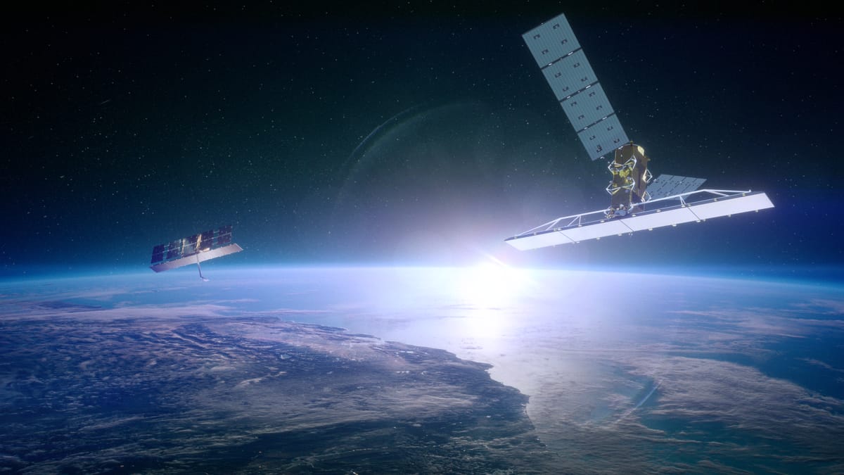
MDA Space’s Earth observation constellation, CHORUS aims to monitor maritime traffic and provide vessel detection and tracking capabilities. (Credit: MDA Space)
21 May, 2025
Satellites are playing an increasingly critical role in maritime information gathering and security, driven by geopolitical tensions, economic chokepoints, and illegal maritime activity. A new report from Quilty Space highlights the growing demand for space-based maritime surveillance, as the governments and industries seek to improve maritime domain awareness (MDA)—the ability to track and assess ship movements globally.
Recent incidents, including Houthi attacks in the Red Sea, Chinese naval assertiveness in the South China Sea, and piracy off West Africa, have exposed vulnerabilities in global shipping networks. Additionally, the fight against illegal fishing, particularly targeting China’s distant-water fleets, has accelerated the adoption of satellite intelligence.
Emerging technologies, such as onboard data processing, aim to reduce latency in maritime intelligence. Companies like Canada’s MDA Space are developing radar satellite constellations to deliver faster insights, addressing challenges posed by dark ships that evade traditional tracking methods.
US Military Conducts a 4,200-Mile Intercontinental Ballistic Missile Test to Assess Nuclear Readiness

At 12:01 a.m. Pacific Time on May 21, 2025, an unarmed Minuteman III Intercontinental Ballistic Missile was launched from Vandenberg Space Force Base, California, as part of an operational test. (Credit: U.S. Space Force photo by Senior Airman Kadielle Shaw)
21 May, 2025
The U.S. Air Force conducted a test launch of an unarmed Minuteman III intercontinental ballistic missile (ICBM) from Vandenberg Space Force Base, California, on May 21, 2025. The missile traveled 4,200 miles (6759 kilometers) to the Ronald Reagan Ballistic Missile Defense Test Site in the Marshall Islands, demonstrating the readiness and reliability of the nation’s nuclear deterrent.
Officials emphasized that the test was not a response to current world events, but part of ongoing assessments to ensure the safety, security, and effectiveness of the U.S. nuclear arsenal. The Minuteman III, operational since the 1970s, is set to be replaced by the LGM-35 Sentinel ICBM in the coming years. The test was overseen by Air Force Global Strike Command, with support from multiple missile wings.

COMMERCIAL
Iceye US Advocates SAR Technology for Enhanced Missile Detection, Pushes for Radar Satellite Integration in US Defense Systems

The satellite image shows an ICEYE Synthetic Aperture Radar (SAR) Spot Extended Area (SLEA) mode image covering an area of 20 km x 20 km of the Salar de Atacama in Chile, captured on June 5, 2024. (Credit: Iceye)
19 May, 2025
The U.S. missile defense landscape is evolving, with commercial radar satellite firms seeking a role in national security operations. Iceye U.S., a subsidiary of Finnish radar satellite operator Iceye, is advocating for the integration of synthetic aperture radar (SAR) satellites into missile defense systems. Traditionally, the U.S. military relies on infrared (IR) sensors to detect missile launches, but Iceye argues that SAR satellites could enhance persistent monitoring and accuracy.
The push for commercial involvement aligns with the Golden Dome for America executive order, which prioritizes modernizing missile defense architecture through commercial technologies. Iceye CEO Eric Jensen emphasizes that existing SAR satellites already provide valuable operational data, suggesting they could complement traditional defense sensors.
Meanwhile, the National Reconnaissance Office (NRO) is refining plans to procure commercial SAR data in 2025, signaling growing interest in leveraging private-sector capabilities for defense applications.
Sophia Space, PiLogic, Voyager Technologies, MDA Space, & SatixFy Drive Space Sector Investments
The space sector is new investments and corporate maneuvering, with multiple companies securing funding or making strategic moves to expand their presence in orbital computing, AI-driven satellite models, and commercial space infrastructure.
19 May, 2025
Sophia Space, a Southern California startup, raised $3.5 million to develop orbiting compute and data centers, aiming to enhance geospatial intelligence and disaster monitoring. Their TILE platform, designed for low-latency AI processing, promises to deliver real-time insights directly from space.

Voyager Technologies has submitted its IPO filing, disclosing financial details and outlining plans for its biggest initiative. (Credit: Voyager Technologies)
19 May, 2025
In a major corporate shift, Voyager Technologies has filed for an initial public offering (IPO), signaling its intent to expand its commercial space station project, Starlab. The company, which holds a 67% stake in the Starlab joint venture with Airbus, aims to position itself as a leader in private space infrastructure, potentially replacing the International Space Station post-2030.
Voyager Technologies’ draft prospectus does not disclose the number of shares or expected IPO proceeds. Formerly Voyager Space, it rebranded in January amid its confidential IPO filing to highlight its defense focus. In 2024, revenue was evenly split between defense and space, but defense accounted for two-thirds in Q1 this year.
20 May, 2025
Additionally, MDA Space has increased its bid for SatixFy by 43%, raising its offer to $280 million (or $3 per share) after facing a competing bid from an undisclosed third party valued at $2.53 per share. SatixFy, an Israeli satellite communications technology provider, specializes in beam-forming—a signal processing technique used in satellite communications to electronically steer and shape antenna beams—and electronically steered antennas, critical for next-generation satellite networks.
22 May, 2025
Meanwhile, PiLogic, another California-based AI startup, secured $4 million in seed funding to advance precision AI models for satellite diagnostics and tracking. Their "exact AI" architecture, validated by NASA, enables high-speed, low-power decision-making onboard satellites, improving autonomous operations in space.
Korean SI Imaging Services, British SatVu & Finnish Kuva Space Expand Remote Sensing Amid US Budget Uncertainty
The commercial satellite imaging sector saw some significant shifts, with new business models emerging alongside concerns over potential budget cuts.

SI Imaging Services' SpaceEye-T published this satellite image of the Forbidden City in Beijing, China on March 21, 2025. (Credit: SIIS)
19 May, 2025
SI Imaging Services, a South Korean company, is introducing a leasing model for its high-resolution SpaceEye-T satellite, allowing customers to control satellite operations directly. This approach, described as an “Airbnb for remote-sensing satellites,” offers end-to-end encryption and automated data deletion, ensuring privacy for users. The 650-kilogram SpaceEye-T satellite, launched in March, provides 25-centimeter resolution imagery, with leasing services set to begin in October. Plans for another high-resolution SpaceEye-T satellite launch in 2027 and two more in 2028, are already in place.
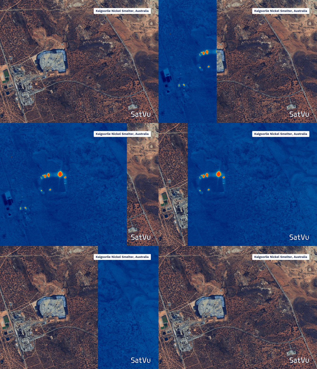
The HotSat-1 image, reveals thermal signals indicating the operational status of smelters and storage tanks at a nickel smelter in Kalgoorlie, Australia. (Credit: SatVu)
19 May, 2025
SatVu’s thermal imaging satellite program is gaining traction despite an early setback. The company’s first satellite, HotSat-1, launched in June 2023, suffered a premature failure after six months in orbit. However, the data collected during its brief mission demonstrated the commercial value of high-resolution mid-wave infrared (MWIR) sensing, leading to $6 million in pre-orders for its successor, HotSat-2.
SatVu’s HotSat satellites use thermal imaging instead of visible light to detect infrared radiation emitted by objects on Earth, creating detailed heat maps that show temperature variations across landscapes and infrastructure. With sensors capable of detecting heat signatures as small as 3.5 meters, they enable precise analysis of individual buildings and industrial sites.
Manufactured for the British SatVu by Surrey Satellite Technology Ltd., a subsidiary of Airbus, HotSat-2 is expected to launch later this year, with improvements to avoid previous mechanical issues. SatVu’s technology enables detailed heat mapping, supporting applications in urban planning, industrial monitoring, and climate research.
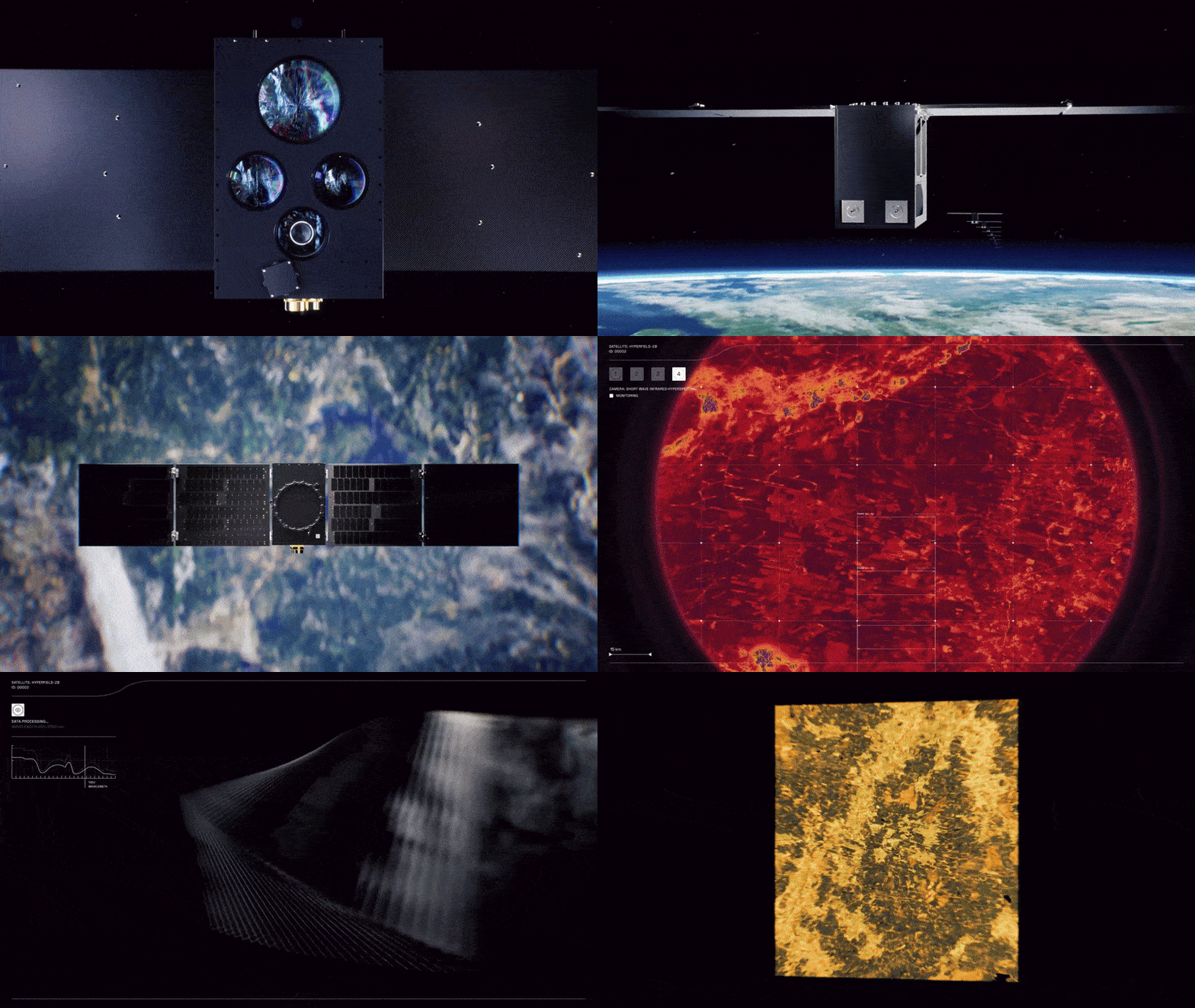
Kuva Space is designing its hyperspectral imagery constellation to highlight anomalies in vast areas like the Arctic and the South China Sea. (Credit: Kuva Space)
20 May, 2025
Meanwhile, Kuva Space, a Finnish hyperspectral imaging startup, is expanding its focus on maritime-domain awareness. Its Hyperfield-1B satellite, scheduled for launch in June, will enhance dark vessel detection, identifying ships that disable their tracking systems. Kuva’s 100-satellite constellation, expected by the end of the decade with plans for launches to begin in 2026, aims to provide near real-time monitoring, benefiting sectors like agriculture and aquaculture.
20 May, 2025
However, in the U.S., the National Reconnaissance Office (NRO) has warned commercial satellite firms of potential budget cuts in 2026. The administration is reportedly considering a 30% reduction in commercial imagery spending, affecting providers under the Electro-Optical Commercial Layer (EOCL) contract, including Maxar Technologies, Planet Labs, and BlackSky. Industry executives fear this shift could undermine national security and disaster relief operations, as the EOCL program supplies high-resolution imagery to U.S. defense and intelligence agencies.
Starfish Space Prepares for First Commercial Satellite Docking in Low Earth Orbit

A render of a Starfish Space Otter servicing satellite approaching a D-Orbit ION vehicle on the upcoming Otter Pup 2 mission. (Credit: Starfish Space)
20 May, 2025
Starfish Space is preparing for a satellite servicing mission, aiming to conduct the first-ever commercial docking in low Earth orbit (LEO). The company’s Otter Pup 2 spacecraft is set to launch on SpaceX’s Transporter-14 rideshare mission in June, where it will attempt to rendezvous and autonomously dock with a D-Orbit ION satellite—a spacecraft that lacks a dedicated docking mechanism. Instead, Starfish Space’s Nautilus capture system will use an electrostatic attachment method, allowing it to interface with unprepared satellites and attach to a flat surface.
This demonstration is crucial for Starfish’s future Otter servicing vehicles, which aim to extend satellite lifespans, refuel spacecraft, and remove orbital debris. If successful, the mission will validate autonomous docking technologies, paving the way for satellite servicing contracts with NASA, the U.S. Space Force, and Intelsat in 2026
This mission follows the Otter Pup 1 test in 2023, which faced deployment challenges but successfully conducted proximity operations.
Axiom Space Prepares to Launch Ax-4 on June 8, First ISS Mission for India, Poland, & Hungary

Axiom Space's Ax-4 mission crew for ISS, from left to right: pilot Shubhanshu Shukla, commander Peggy Whitson, mission specialist Sławosz Uznański and Tibor Kapu. (Credit: Axiom Space)
21 May, 2025
Axiom Space’s Ax-4 mission is set to launch on June 8 aboard a SpaceX Falcon 9 rocket, carrying a multinational crew to the International Space Station (ISS). The mission will be commanded by Peggy Whitson, a former NASA astronaut and Axiom’s director of human spaceflight. Her crewmates include pilot Shubhanshu Shukla of India’s Indian Space Research Organisation (ISRO), mission specialist Sławosz Uznański of Poland and the European Space Agency (ESA), and mission specialist Tibor Kapu of Hungary. The flight marks the first ISS mission for India, Poland, and Hungary.
Ax-4 will conduct 60 science and outreach activities, with contributions from 31 countries, including 17 experiments supported by ESA and 25 from Hungary’s HUNOR astronaut program. The mission comes amid NASA budget concerns, with private initiatives like Ax-4 helping sustain ISS operations.
Dawn Aerospace Announces Aurora Spaceplane Sales, First Deliveries in 2027

Dawn Aerospace’s Mk-II Aurora taking off for a vehicle test flight in November 2024, with Mt. Cook in the back. (Credit: Dawn Aerospace)
22 May, 2025
Dawn Aerospace has begun sales of its Aurora suborbital spaceplane, marking a shift in how high-altitude missions are conducted. Unlike traditional rockets, Aurora operates like an aircraft, taking off and landing on standard runways while reaching Mach 3.5 and altitudes beyond 100 km.
The company, headquartered in New Zealand and the Netherlands, aims to provide frequent, cost-effective access to microgravity for scientific research, defense applications, and semiconductor testing. With deliveries expected in 2027, Aurora’s reusability and rapid turnaround could reshape suborbital flight operations, offering on-demand access to space for commercial and government customers.

RESEARCH SPOTLIGHT
Chinese Researchers Find Binary System with Evidence of a Star Orbiting Inside Its Companion

An animation showing two stars orbiting each other in a binary system. (Credit: NASA's Goddard Space Flight Center/Chris Smith (USRA))
Astronomers in China while investigating a pulsar, PSR J1928+1815 located about 455 light-years from Earth, have identified a rare binary star system where one star once orbited inside its companion. The system consists of a millisecond pulsar—a rapidly spinning neutron star, completing a full rotation in just a few milliseconds, often hundreds of times per second—and a helium star stripped of its hydrogen layers.
Using China’s Five-hundred-meter Aperture Spherical Telescope (FAST)—the world’s largest single-dish radio telescope—discovered that PSR J1928+1815 is paired with a helium star 1 to 1.6 times the Sun’s mass. This star has shed most or all of its hydrogen, leaving behind a helium-rich core. Researchers suggest the system formed through common envelope evolution, a process where the pulsar spiraled inward within its companion’s outer layers before ejecting them, leaving behind a tightly bound pair. This discovery provides new insights into binary star evolution, with estimates suggesting only 16 to 84 similar systems may exist in the Milky Way.
The binary system is remarkably compact, with the stars separated by just 700,000 miles (1.12 million km)—around 50 times closer than Mercury is to the Sun. According to the study’s co-author and chair of the radio astronomy division of the National Astronomical Observatories of the Chinese Academy of Sciences in Beijing, Jin-Lan Han of the National Astronomical Observatories of China, they complete an orbit in 3.6 hours. The study was published the journal Science.
Study Suggests Jupiter Was Twice Its Current Size in Early Solar System

An illustration of Jupiter with magnetic field lines emitting from its poles. (Credit: K. Batygin)
A new study led by Caltech and the University of Michigan suggests that Jupiter was once twice its current size, with a predicted volume that is the equivalent of over 2,000 Earths and had a magnetic field 50 times stronger than today. Researchers analyzed the orbits of Jupiter’s inner moons, Amalthea and Thebe, using their slight tilts as clues to reconstruct the gas giant’s primordial state.
Their findings indicate that 3.8 million years after the solar system’s first solids formed, Jupiter was still contracting from its early phase of rapid gas accretion. This research provides a clearer picture of planet formation dynamics, offering insights into how Jupiter shaped the architecture of the solar system. The findings were published in the journal Nature Astronomy.
Kyushu University Study Examines Atmospheric Effects of the 2024 Mother’s Day Solar Storm

NASA’s Scientific Visualization Studio image of Earth’s magnetosphere impacted by the Mother’s Day geomagnetic storm (May 10–11, 2024). The storm triggered auroras at unusually low latitudes and, as Kyushu University researchers found, also enhanced sporadic E layers in the ionosphere. (Credit: NASA’s Scientific Visualization Studio and NASA DRIVE Science Center for Geospace Storms link)
A recent study by Kyushu University has revealed unexpected effects of the 2024 Mother's Day geomagnetic storm on Earth's upper atmosphere. Researchers found that the storm significantly enhanced sporadic E layers—thin, dense patches of ionized metals in the E layer of the ionosphere (90–120 km above sea level).
Using data from COSMIC-2 satellites and ground-based ionosondes, scientists mapped the phenomenon globally. The sporadic E layers first appeared at high latitudes before spreading toward the equator, likely due to disturbed neutral winds.
These findings help explain how solar storms impact radio signals, GPS accuracy, and communication systems, affecting aviation, navigation, and emergency response networks. As geomagnetic disturbances become more frequent during periods of high solar activity, improving forecasts could help mitigate disruptions, ensuring reliable connectivity for global infrastructure. The paper was published last month in the journal Geophysical Research Letters.
Despatch Out. 👽🛸


